



Find your rooftop
Search by address and inspect the satellite view. Select a detected building footprint or draw the roof boundary yourself.
Explore your rooftop’s solar potential. Map the available space, account for obstacles and maintenance access, and estimate panel capacity, energy generation, potential savings, payback period, and environmental impact.
How it works
Find your roof, design a practical panel layout, and estimate its energy, financial, and environmental impact.
Search by address and inspect the satellite view. Select a detected building footprint or draw the roof boundary yourself.
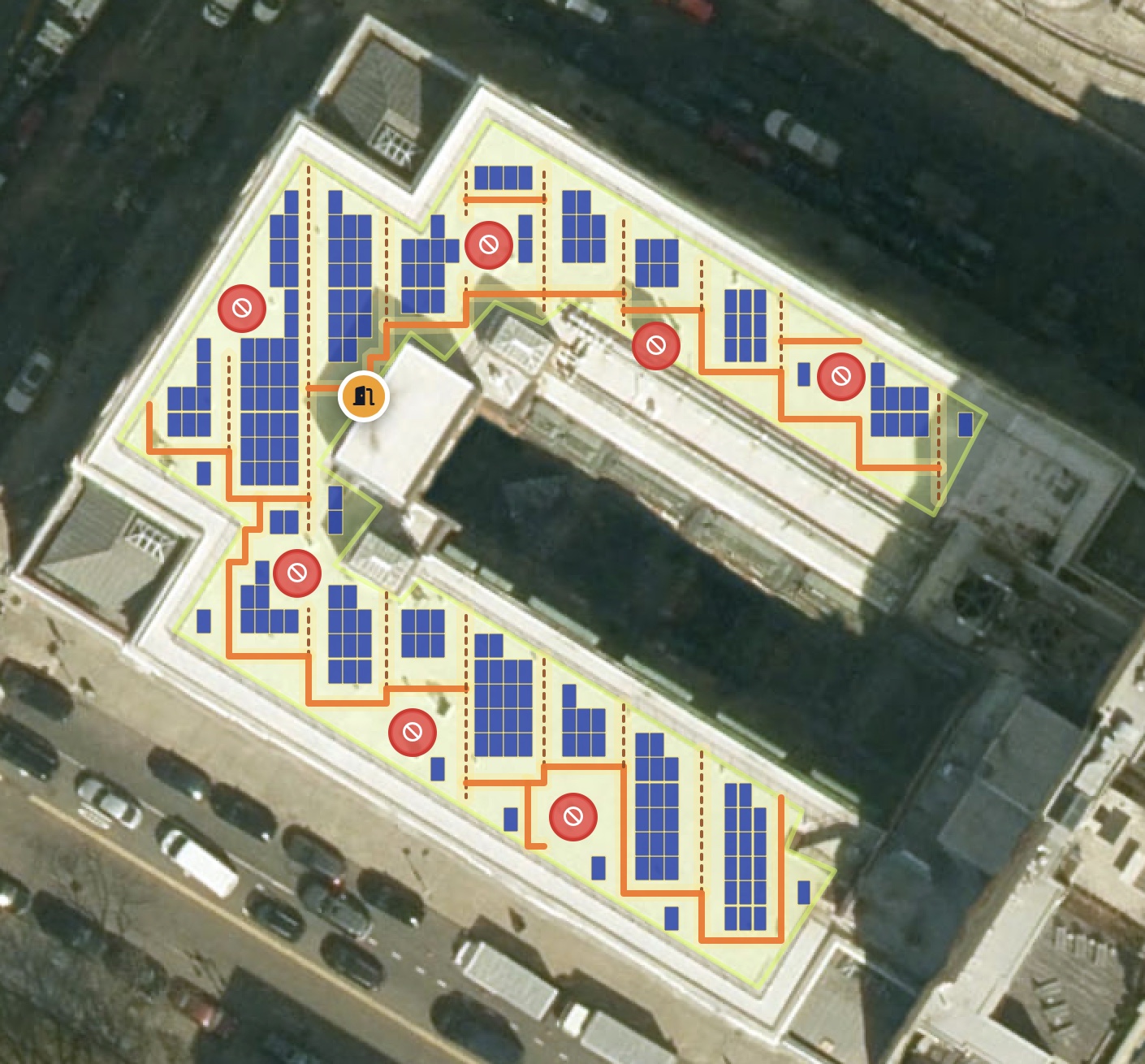
Mark obstacles, rooftop access, and maintenance paths. RoofGrid then arranges panels within the remaining usable area.
Estimate energy generation, installation cost, savings, payback period, and avoided carbon emissions using assumptions you can review and edit.
Features
Review the detected boundary, individual panel placement, access route and obstacles directly over the map.
Work with standard panel formats and layout controls rather than a single invisible assumption.
Start from worldwide search and localize the financial model to your market.
Move from physical capacity to generation estimates, bill savings, cost and environmental impact without losing the assumptions behind the result.
Contact Us
Share your question or feedback. Your message will be delivered directly to our inbox.